Trip Report - The Great Loess Hills Scenic Byway Trip of 2021
15/01/21 22:19 Filed in: Trip Reports
I grew up in Council Bluffs, Iowa. We learned early on that the "bluffs" part of Council Bluffs were 'loess hills', and consisted of windblown soil. I have long known that there is a national scenic byway through the loess hills, starting just north of the Missouri-Iowa border and extending to the Iowa-South Dakota border.
In mid-January 2020, my brother, David, and I drove the northern portion of the byway in ESCAPE POD. Although the weather was cold and the trees held no leaves, we still had a great time and enjoyed the drive and time together,
In mid-January 2020, my brother, David, and I drove the northern portion of the byway in ESCAPE POD. Although the weather was cold and the trees held no leaves, we still had a great time and enjoyed the drive and time together,
The Loess Hills National Scenic Byway
This is from the Loess Hills National Scenic Byway web page:
Situated along Iowa's western border, the Loess Hills National Scenic Byway passes through a unique land formation that is up to 15 miles wide and about 200 miles long from north of Sioux City, Iowa to near St. Joseph, Missouri.
The Loess Hill consist almost entirely of windblown soils. Toward the end of the last ice age, winds picked up soils that had been ground as fine as flour and formed dunes along the ancient waterway that became today's Missouri River. The process repeated itself during the thousands of years the ice age took to end, enlarging the dunes. Because the prevailing winds were from the northwest, the dunes on the Iowa side of the river were higher than those west of the Missouri.
Today, the definition of a Loess Hill is a hill made of loess that is more than 60 feet in height; using that definition, about 640,000 acres of land in western Iowa constitute the Loess Hills landform.
Although deposits of loess are found across the world, nowhere else but China are those deposits higher than they are in Iowa.
We started our journey north out of Council Bluffs, and quickly headed into the loess hills. The twists and turns of the road made for some fun driving, while we talked about the area and the towns we passed, The byway signs helped with our navigation as we headed north out of Council Bluffs.
It was a cold day, with steel gray winter skies, but we were warm and cozy in the small cockpit of ESCAPE POD. Having the Sirius XM satellite radio was a real treat, and we listened to some great soul, Motown, and jazz music as we drove the loess hills of western Iowa.
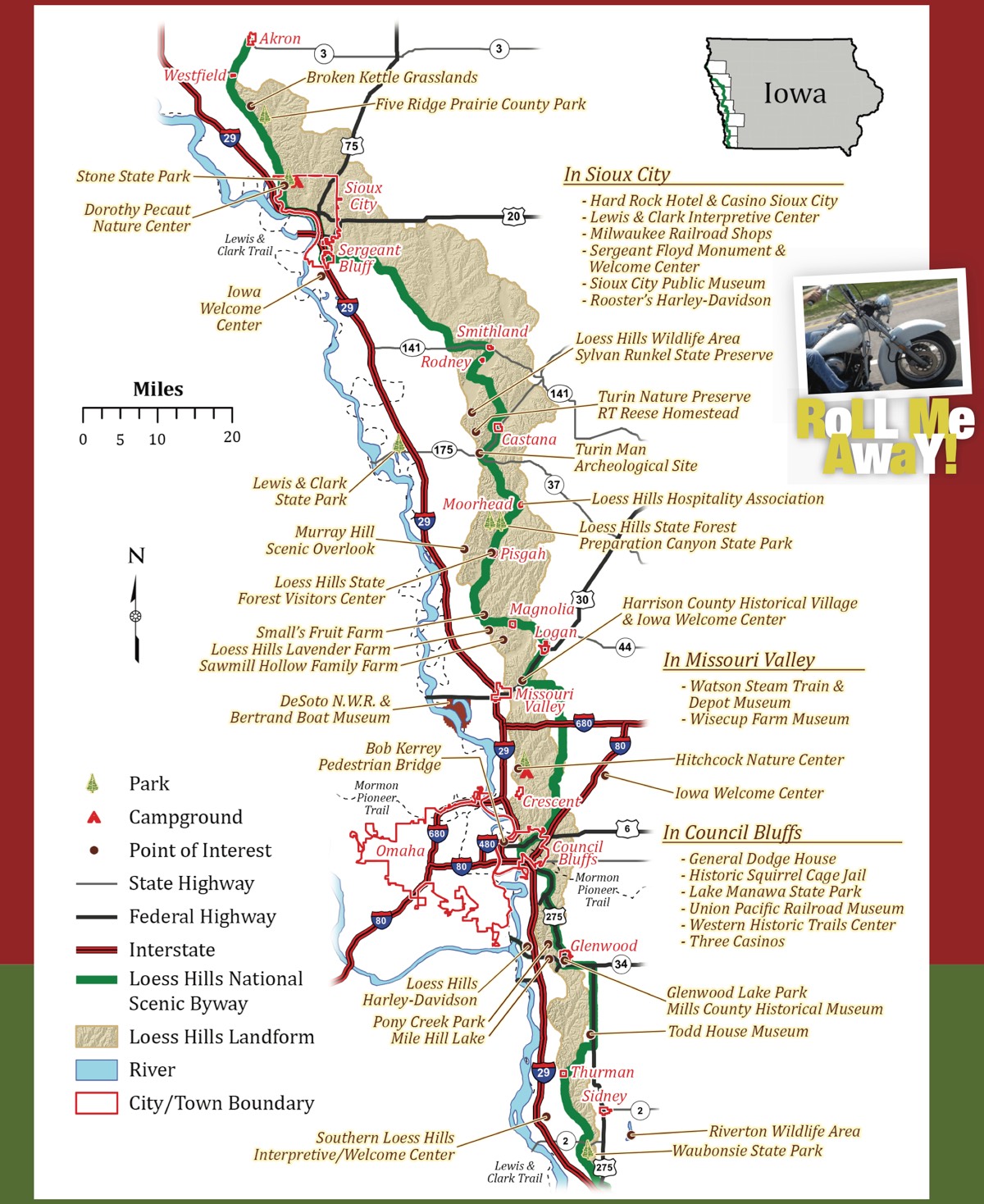
Good map of the Loess Hills Historical Scenic Byway (from a nice motorcycle ride brochure):

Just a Couple of Hardy Adventurers Hitting the Road!

Although the ESCAPE POD gets nearly 30 miles to the gallon, it has less than 12 gallon capacity gas tank! So, while driving the back roads of rural western Iowa, I was closely watching the fuel gauge slowly drop toward 'E" and fretting about finding an open gas station. We eventually decided to descend from the hills to the Missouri River flood plain and hit a fuel stop over by the nearby Interstate, then ascend back into the hills to continue our journey.
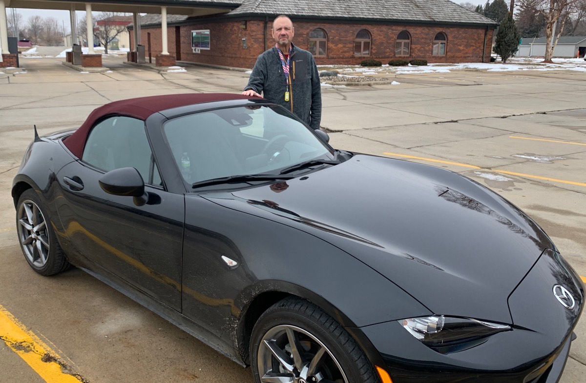
A more relaxed Bret after filling up the gas tank (for the second time!)

The city was named in honor of U.S. Army Sergeant Charles Floyd, a native of Kentucky who was one of the first men to enlist in the Lewis and Clark Expedition in the early 1800s. Just three months into the two-year journey, Floyd became violently ill and died the next day, August 20, 1804, of what is believed to have been a ruptured appendix. He was buried on a hill overlooking an unnamed river on the Iowa side of the Missouri River.
In his honor, the expedition's leaders, Meriwether Lewis and William Clark, named the river Floyd River and the hill Floyd's Bluff, now part of Sioux City. Floyd was the expedition's only casualty.
As we came down out of the Loess Hills at Sargent Bluff, it was nearing lunch time, and we both were ready for some food. A quick search on the mobile devices revealed several options. Our original choice was closed down (possibly a victim of the COVID slump), but we spied a promising alternative nearby - Mateo Kitchen, a 'Fil-Am Kitchen'. Assuming that Fil-Am meant 'Filipino-American', and both of us having adventurous spirits when it comes to trying new things, we took a chance and gave it a try. And we were glad that we did!
Mateo Kitchen - Filipino-American Cuisine
We ordered some fish balls as an appetizer and discussed the day's specials with the server. David ordered the beef special and I ordered Kare-Kare, a beef stew with peanut sauce. Each dish came with garlic rice. The fish balls were interesting, and the entrees were delicious! We both agreed that we would eat there again if we were back in the area.
The Fish Ball Appetizer

Marinated Beef with Vegetables

Kare-Kare (Beef Stew with Peanut Sauce)

The Loess Hills Scenic Byway was a very pleasant drive, and I hope to travel it again when the weather is warmer and the tress are greener. We had a great time.
Here's a nice video of the Loess Hils National Scenic Byway:
Situated along Iowa's western border, the Loess Hills National Scenic Byway passes through a unique land formation that is up to 15 miles wide and about 200 miles long from north of Sioux City, Iowa to near St. Joseph, Missouri.
The Loess Hill consist almost entirely of windblown soils. Toward the end of the last ice age, winds picked up soils that had been ground as fine as flour and formed dunes along the ancient waterway that became today's Missouri River. The process repeated itself during the thousands of years the ice age took to end, enlarging the dunes. Because the prevailing winds were from the northwest, the dunes on the Iowa side of the river were higher than those west of the Missouri.
Today, the definition of a Loess Hill is a hill made of loess that is more than 60 feet in height; using that definition, about 640,000 acres of land in western Iowa constitute the Loess Hills landform.
Although deposits of loess are found across the world, nowhere else but China are those deposits higher than they are in Iowa.
We started our journey north out of Council Bluffs, and quickly headed into the loess hills. The twists and turns of the road made for some fun driving, while we talked about the area and the towns we passed, The byway signs helped with our navigation as we headed north out of Council Bluffs.
It was a cold day, with steel gray winter skies, but we were warm and cozy in the small cockpit of ESCAPE POD. Having the Sirius XM satellite radio was a real treat, and we listened to some great soul, Motown, and jazz music as we drove the loess hills of western Iowa.
Good map of the Loess Hills Historical Scenic Byway (from a nice motorcycle ride brochure):

Just a Couple of Hardy Adventurers Hitting the Road!

Joys of an 11.9 gallon gas tank
Although the ESCAPE POD gets nearly 30 miles to the gallon, it has less than 12 gallon capacity gas tank! So, while driving the back roads of rural western Iowa, I was closely watching the fuel gauge slowly drop toward 'E" and fretting about finding an open gas station. We eventually decided to descend from the hills to the Missouri River flood plain and hit a fuel stop over by the nearby Interstate, then ascend back into the hills to continue our journey.
A more relaxed Bret after filling up the gas tank (for the second time!)

End of the Line at Sargent Bluff
We ended our Byway journey at Sargent Bluff, Iowa, just south of Soux City. Sargent Bluff has an interesting history (courtesy of Wikipedia):The city was named in honor of U.S. Army Sergeant Charles Floyd, a native of Kentucky who was one of the first men to enlist in the Lewis and Clark Expedition in the early 1800s. Just three months into the two-year journey, Floyd became violently ill and died the next day, August 20, 1804, of what is believed to have been a ruptured appendix. He was buried on a hill overlooking an unnamed river on the Iowa side of the Missouri River.
In his honor, the expedition's leaders, Meriwether Lewis and William Clark, named the river Floyd River and the hill Floyd's Bluff, now part of Sioux City. Floyd was the expedition's only casualty.
An Unexpected Treat - Lunch in the Philippines!
As we came down out of the Loess Hills at Sargent Bluff, it was nearing lunch time, and we both were ready for some food. A quick search on the mobile devices revealed several options. Our original choice was closed down (possibly a victim of the COVID slump), but we spied a promising alternative nearby - Mateo Kitchen, a 'Fil-Am Kitchen'. Assuming that Fil-Am meant 'Filipino-American', and both of us having adventurous spirits when it comes to trying new things, we took a chance and gave it a try. And we were glad that we did!
Mateo Kitchen - Filipino-American Cuisine
We ordered some fish balls as an appetizer and discussed the day's specials with the server. David ordered the beef special and I ordered Kare-Kare, a beef stew with peanut sauce. Each dish came with garlic rice. The fish balls were interesting, and the entrees were delicious! We both agreed that we would eat there again if we were back in the area.
The Fish Ball Appetizer

Marinated Beef with Vegetables

Kare-Kare (Beef Stew with Peanut Sauce)

There and Back Again
After our pleasant lunch, we hopped into the ESCAPE POD, and headed south on nearby I-29. The car easily can keep up with the interstate traffic, although it is a bit unnerving to pass semi tractor-trailers whilst looking at the lug nuts of their tires!The Loess Hills Scenic Byway was a very pleasant drive, and I hope to travel it again when the weather is warmer and the tress are greener. We had a great time.
Here's a nice video of the Loess Hils National Scenic Byway: